
How to Walk an Oceanside Street Directory
Begin with a complete Oceanside street address and give each source one role. In the Oceanside GIS viewer, enter the address and note the parcel outline, situs label, APN, and nearby parcels. A full Oceanside APN can then be entered in the 2026 Secured Assessment Roll Search to read land, improvement, and total assessed values. The Oceanside roll is strong for parcel facts, but it does not publish owner names online under Government Code §6254.21. Deed-party evidence must come through Oceanside ARCC channels.
Move from the Oceanside parcel to a person only after the parcel is stable. Search the Oceanside ARCC Official Records Index by party, type, date, document number, or book/page. The Oceanside public index reaches 1970-present and displays metadata. Images require a mailed or purchased copy, or an office kiosk. The Oceanside web APN search was removed on December 9, 2024, while five office kiosks retain APN searching.
- Normalize the Oceanside address in GIS and record the APN, parcel shape, subdivision context, and situs spelling.
- Enter the full APN in the Oceanside secured roll and save the assessed values, exemptions, and value-change context shown online.
- Use a lawful Oceanside ARCC copy or counter channel for deed parties, then search the index by name and date.
- Check Oceanside permits in eTRAKiT, treating applicants, contractors, work scope, and inspection dates as project evidence.
- Use the authenticated voter lookup for the voter’s status, then consult older Oceanside directories and street-name history.
The Oceanside sequence separates a parcel, owner, occupant, and historic listing. It also records the stopping point: Oceanside assessor ownership is suppressed online, Oceanside recorder images require copy or kiosk access, and directory runs may be unconfirmed.
Oceanside GIS for Street-by-Street Selection
Oceanside GIS is the practical street-browse tool. Oceanside Quick Search and Find Address locate a situs or intersection; Identify reveals the clicked feature. Oceanside Search Fields and Selectable Layer change by layer. Select Point, Line, Shape, Current View, or All, then add a distance in feet or select nearby features within that range.
| GIS control | Type | Required or options |
|---|---|---|
| Quick Search / Find Address | Text or autocomplete | Address; intersection format Street A & Street B |
| Search Fields | Dropdown | Layer-dependent |
| Identify | Map click | Clicked feature |
| Selectable Layer | Dropdown | Choose the feature layer |
| Geometry | Buttons | Point / Line / Shape / Current View / All |
| Add a buffer with distance (ft) | Number | Optional feet |
| Select nearby features within (ft) | Number | Optional feet |
| Selection operation | Buttons | New Selection / Add to / Remove from |
| Output | Controls | Details / Table / CSV / Mailing labels / Zoom all / Clear |
Start with New Selection and add only the needed layer. The Oceanside viewer’s Details and Table view help inspect results before export. Oceanside CSV and Mailing labels are outputs, not proof that every feature is a household. Current View clips a long street to the visible extent.
Note: Keep the Oceanside map at the visible block or street extent; current-extent clipping keeps exports focused.
From an Oceanside Situs to APN Facts
An Oceanside parcel is defined land; its situs address is its physical location. An Oceanside APN is the county identifier. An Oceanside plat maps lots, blocks, streets, and easements. These terms anchor an address trail when a number changes or a parcel splits. Record GIS legal or subdivision context before treating records as the same place.
The Oceanside assessor accepts a full APN in 123-456-78-90 form, with a minimum eight-digit 123-456-78. The Oceanside roll shows land, improvement, and total assessed values, exemptions where displayed, Proposition 13 base or factored values, and value-change reasons. Owner and owner mailing address are absent online. Oceanside Public Information questions go to (619) 236-3771.
For a visual reference, the San Diego County secured assessment search shows the APN-only search and its owner-privacy notice.
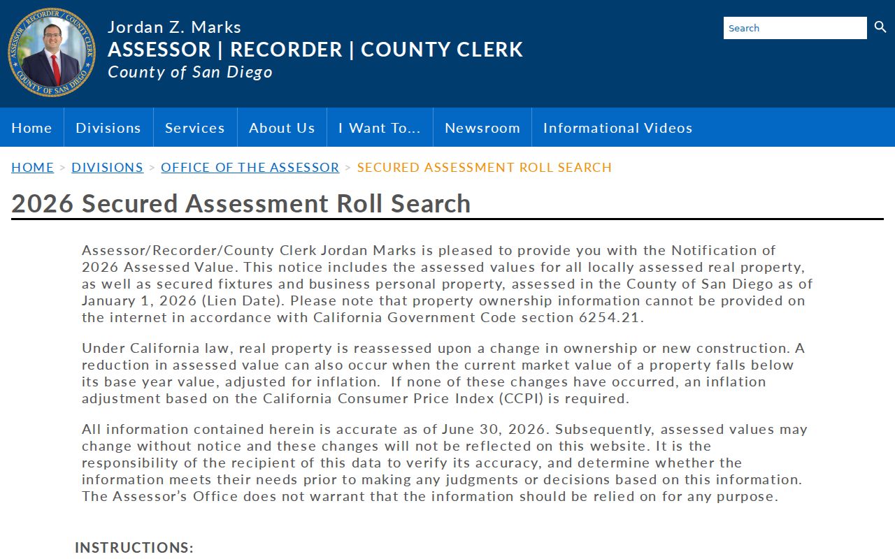
The screenshot shows why assessment values do not identify a person; deed index, copy, or kiosk evidence is needed for title.
- Parcel
- A mapped land unit with a boundary and county identifier, which may change after a split or merger.
- Situs address
- The physical location of the parcel, not necessarily the place where an owner receives mail.
- Plat
- A recorded subdivision or tract map used to connect lot, block, street, and legal-description clues.
- Criss-cross directory
- A reverse directory section arranged by street and number, with listed occupants for a particular historical snapshot.
Note: Assessed value is a tax-roll fact, not proof that the parcel owner lives at the Oceanside situs address.
Oceanside Records Along a Street
Oceanside has no single public roll for everyone along a street. This Oceanside address map joins systems by address, APN, legal description, date, and source limits. Oceanside’s table shows each system’s contribution and access.
| Record set | Keeper | What it shows | Access |
|---|---|---|---|
| Parcel geometry and address | City of Oceanside GIS | Situs, shape, nearby parcels, layers, and district context | Free interactive viewer |
| Secured assessment roll | San Diego County Assessor | APN, land and improvement values, exemptions, and value changes | Full APN web search; owner name suppressed |
| Official records | San Diego County Recorder | Indexed parties, document type, recording date, number, and book/page | 1970-present metadata; copy or kiosk image |
| Building permits | Oceanside Development Services | Applicant, contractor, scope, valuation, dates, and inspections | eTRAKiT preview plus request fallback |
| Tax bill or status | County Treasurer-Tax Collector | Parcel or bill status | Online parcel route; not occupancy evidence |
| Voter information | San Diego County Registrar of Voters | Authenticated registration status and districts | Self-lookup or qualifying data application |
| Historical reverse directories | Heritage Room and Historical Society | Listed occupants and street sequence for a dated volume | Staff-assisted; exact local runs unconfirmed |
| City records by address | Oceanside City Clerk | Existing council, contract, correspondence, or department records | Published records or CPRA request |
The Oceanside chain is GIS parcel to APN to assessment facts to an ARCC deed-party or copy channel. Oceanside permits add a timeline; Oceanside historical directories and Oceanside voter data answer different questions. The Oceanside City Clerk public-records route accepts a focused request for an existing record, not a new street roster.
Deed Parties After Oceanside APN Search Changed
ARCC combines assessor, recorder, and county-clerk functions. The recording office guidance covers deeds, deeds of trust, reconveyances, liens, releases, easements, maps, and notices. Its Official Records Index is free metadata from 1970-present. Results show party roles, type, date, number, book/page when supplied, and legal or parcel reference. Images are not free web results.
After a lawful copy or counter channel supplies a party name, search variants, initials, trusts, entities, spouses, and dates. Compare the legal description and APN, not just a street number. ARCC lists mailed or purchased copies and office-kiosk viewing. Recording questions go to (619) 238-8158; the general Recorder/Clerk number is (619) 237-0502. APN searching was removed from the web on December 9, 2024, but five office kiosks retain it.
A grantor is the party transferring an interest; a grantee receives it. For address research, the deed establishes a named transfer relationship at a time, not continuous occupancy. A chain can run from a current grantee to an earlier grantor, then backward through that seller’s prior acquisition. Book/page references and the legal description are the bridge when a modern APN or street label no longer matches.
Oceanside Permits Date Work, Not Occupancy
Address-keyed permit records can add the building story. Oceanside eTRAKiT exposes Permits with Apply/New, Pay Fees, and Search Permit; Projects with Apply, Pay Fees, and Search; Contractor Search; Property Search; scheduled inspections; and License actions. The inspected interface is prominently labeled pre-production and warns against real payments. Treat it as an interface preview, verify production access through Development Services, and use a focused Oceanside request when the web view does not answer the record question.
A permit may identify an applicant, contractor, architect, owner at application time, permit type, valuation, issue or final date, and inspection history. Those fields can date an addition, repair, or change of use. They do not prove who occupied the parcel, and an applicant may be an agent or project participant. The Oceanside eTRAKiT interface is the relevant starting point, with the city records-request channel as the fallback.
The permit and property search view shows why the pre-production warning belongs beside any address result.
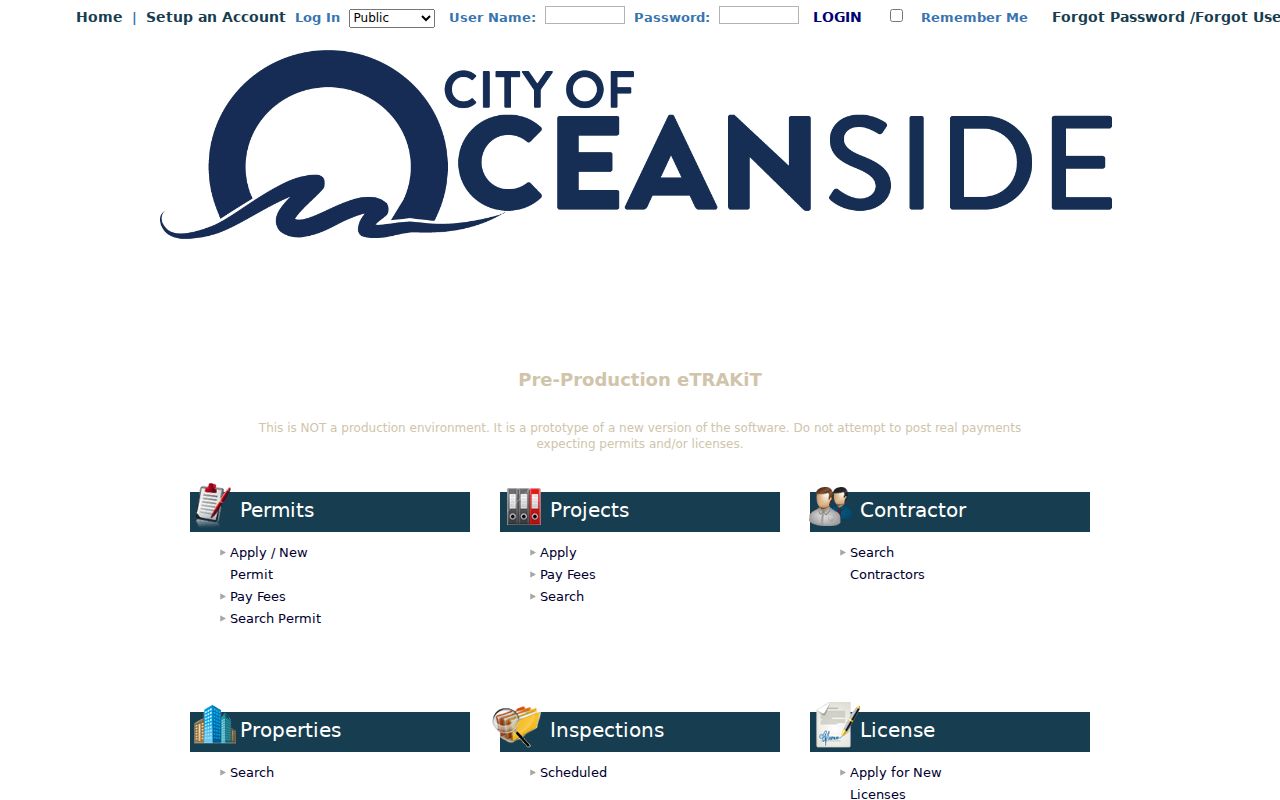
Use permit dates beside deeds, parcel maps, and historical photographs. A project timeline can explain when a street-facing structure changed without turning a permit participant into a claimed resident.
Oceanside Voter Lookup and Street Limits
The San Diego County Voter Information Lookup is an authenticated self-service tool, not an open street roll. It asks for the registered form of the first name, last name, date of birth, residence address, and ZIP Code. A mismatch can produce no registration found even when a person is registered, because one supplied field differs from the file.
- First Name
- Last Name
- Date of Birth in MM/DD/YYYY format
- Residence Address in San Diego County
- ZIP Code
- Submit or Lookup
For an approved full-file request, the Registrar requires a detailed qualifying purpose, requester identity and contact details, record scope, a security and confidentiality plan, delivery details, certification under penalty, and an original signature. The application goes by mail or in person to Registrar of Voters, 5600 Overland Avenue, San Diego CA 92123, or the mailing address at P.O. Box 85656, San Diego CA 92186-5656. Emailed and faxed applications are not accepted. Office hours are 8:00 to 5:00 Monday through Friday, with possible election-season expansion; questions go to (858) 565-5800 or rovmail@sdcounty.ca.gov.
Elections Code §2194 limits registration-data access and use to specified governmental, electoral, scholarly, journalistic, and political purposes. Government Code §7924.000 protects home street address, phone, email, precinct and prior-registration data, identifying numbers, and signatures. Safe at Home participants can register confidentially. The voter lookup can support a person’s own status check, but it cannot lawfully supply a general list of voters on an Oceanside street.
Historic Oceanside Streets in Modern Records
Street names can create false gaps in Oceanside address research. Historical Society material records First Street as Seagaze, Second Street as Mission, Third Street as Pier View Way, Fourth Street as Civic Center Drive, and Hill Street as Coast Highway. Couts Street, where the first pier ended, is now Wisconsin. Search both names, then use a plat, parcel outline, or legal description to prove continuity.
The crosswalk is useful for photographs, newspapers, permits, directories, and deeds. A historic caption that places a house on Third Street may describe the present Pier View Way block. A record tied to Hill Street may sit on the Coast Highway spine. Modern postal labels can also cross city, county, and Camp Pendleton edges, so the mailing city alone is not proof of municipal jurisdiction.
The library began in 1904 and moved through former sites including Third Street, Hill Street, Second Street, 704 Pier View Way, and North Nevada before reaching the Civic Center. Those moves help decode obsolete locations in clippings and photographs. The history timeline adds context but does not replace a parcel or recorded-document check.
Reverse Directories and the Oceanside Shelf Gap
A criss-cross or reverse directory orders a historical volume by street and house number rather than by surname. It may show a listed occupant, telephone entry, or household marker for one annual snapshot. Publicly inspected Oceanside sources do not publish an exhaustive publisher list, exact city-directory years, reverse-directory run, telephone-book run, obituary-index title, or stable digitized sample page. No Polk years or other unverified run should be filled in by guesswork.
Ask the Helen M. Nelson Heritage Room staff for a vertical-file or shelf search by street, subdivision, surname, business, and institution, not only for the words “city directory.” The room holds more than 2,500 Oceanside books, files, clippings, and photographs. Staff permission is obtained at the Civic Center Library second-floor Customer Service Desk. The Weese Collection finding aid adds photographs, maps, organization records, and pointers to Blade-Tribune material.
For the collection itself, the Oceanside Directory Book page keeps shelf research separate from the current by-address chain. When a volume is located, photograph its abbreviation key, search alphabetically, inspect the street section, compare adjacent years, and pair the result with census, deed, permit, newspaper, obituary, or probate evidence.
Note: A no-hit may reflect a former street name, an unconfirmed directory run, or a record series that never offered a public online search.
What an Oceanside Street Directory Cannot Show
An address record does not reveal everyone connected to a home. The assessor suppresses owner names online; a deed names transfer parties, a permit names project participants, and a reverse directory captures only its dated listings. The voter lookup is authenticated and restricted. DMV and utility-customer lists are not open rolls.
Mailing and situs addresses can differ. A mailing address may point to a trust, manager, or remote owner, but it does not establish occupancy. A USPS ZIP lookup verifies delivery, but a ZIP may extend beyond the city; a Camp Pendleton mailing identity does not turn federal land into an Oceanside neighborhood. Use the custodian when needed; record the search date and limits.
Lawful use. Use Oceanside address and property records only for personal, lawful research such as family history or parcel questions. California Penal Code §646.9 defines stalking and §653m addresses repeated harassing communications; do not stalk, harass, threaten, or intimidate anyone.